

The Making of an Island
New land is claimed in many ways. Revolutions are declared, borders are drawn and nations are born. But in this region the land is created. A brand new lighthouse will show the way.
New land is claimed in many ways. Revolutions are declared, borders are drawn and nations are born. But in this region the land is created. A brand new lighthouse will show the way.
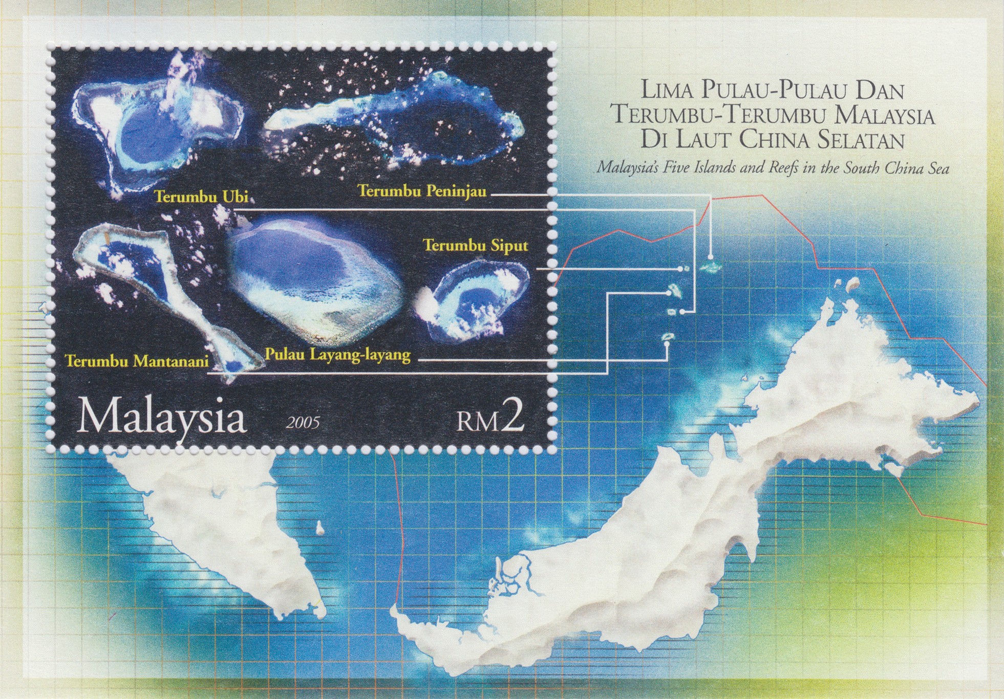
This stamp comes from Malaysia and shows five islands and reefs in the South China Sea. The tiny, white dots are islands; if you follow the white lines you see them on the actual stamp as satellite images, and on some you can even see the dotted overcast clouds. The red line on the map indicates the maritime boundary of Malaysia, meaning this is their part of the sea. (Quite amusingly, it looks as though Malaysia is an island by itself, since the stamp makers have omitted the bordering countries from the map. Brunei is simply a dent in the coastline and Indonesia, which lies south of Malaysia, has disappeared as well.)
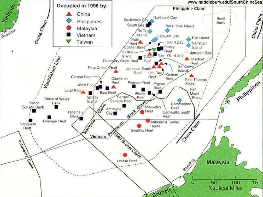
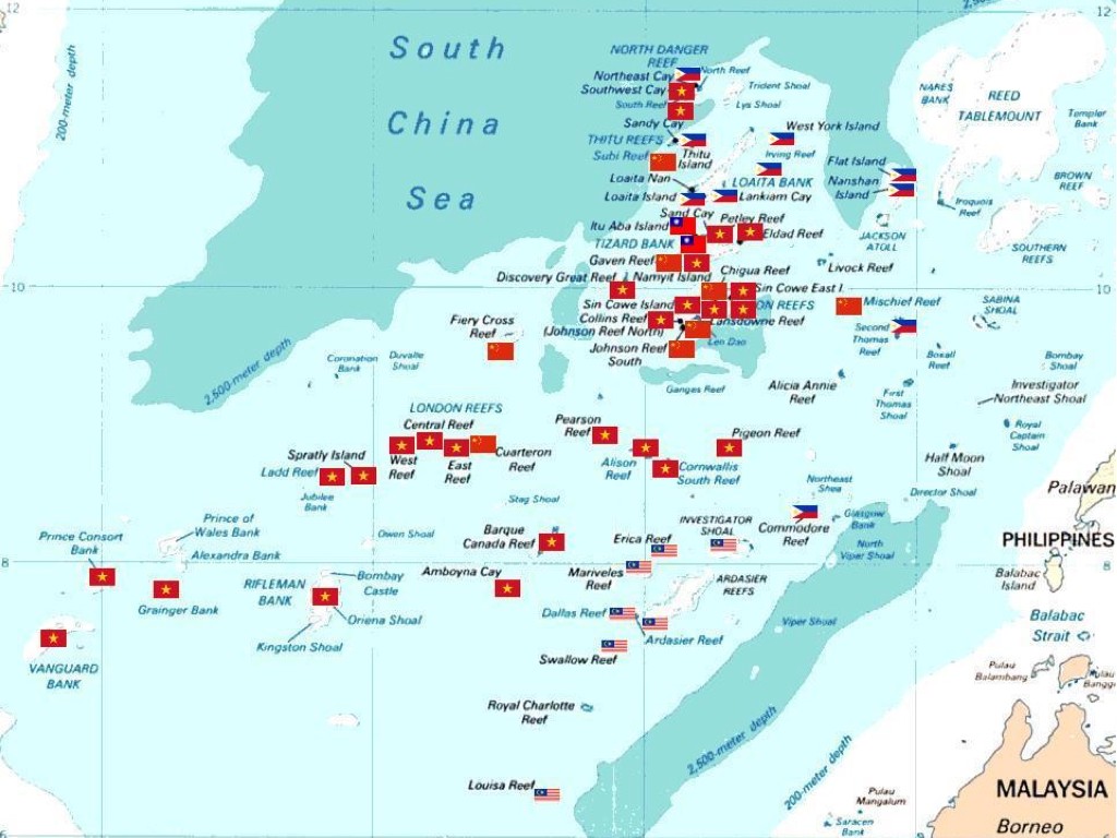
These islands are part of the Spratly Islands and are located in an area of the South China Sea, which is about 1000 km long and 400 km wide. Since this region is of highly economical and strategic importance, many islands are disputed between the bordering countries. Presently Vietnam, China, and Taiwan claim all of the islands, the Philippines claim most of them, and Malaysia claims some of them. Indonesia and Brunei have economic interests in the area although they make no formal claims. The history of ownership of the islands is long and complex, and finding out who claims what is no easy task.
There are numerous maps to be found online, each showing certain preferences.
This very schematic map probably has Vietnamese origins. Vietnam owns most islands on this map, is ranked first in the legend and has a star as a symbol, the national symbol of the Vietnamese flag.

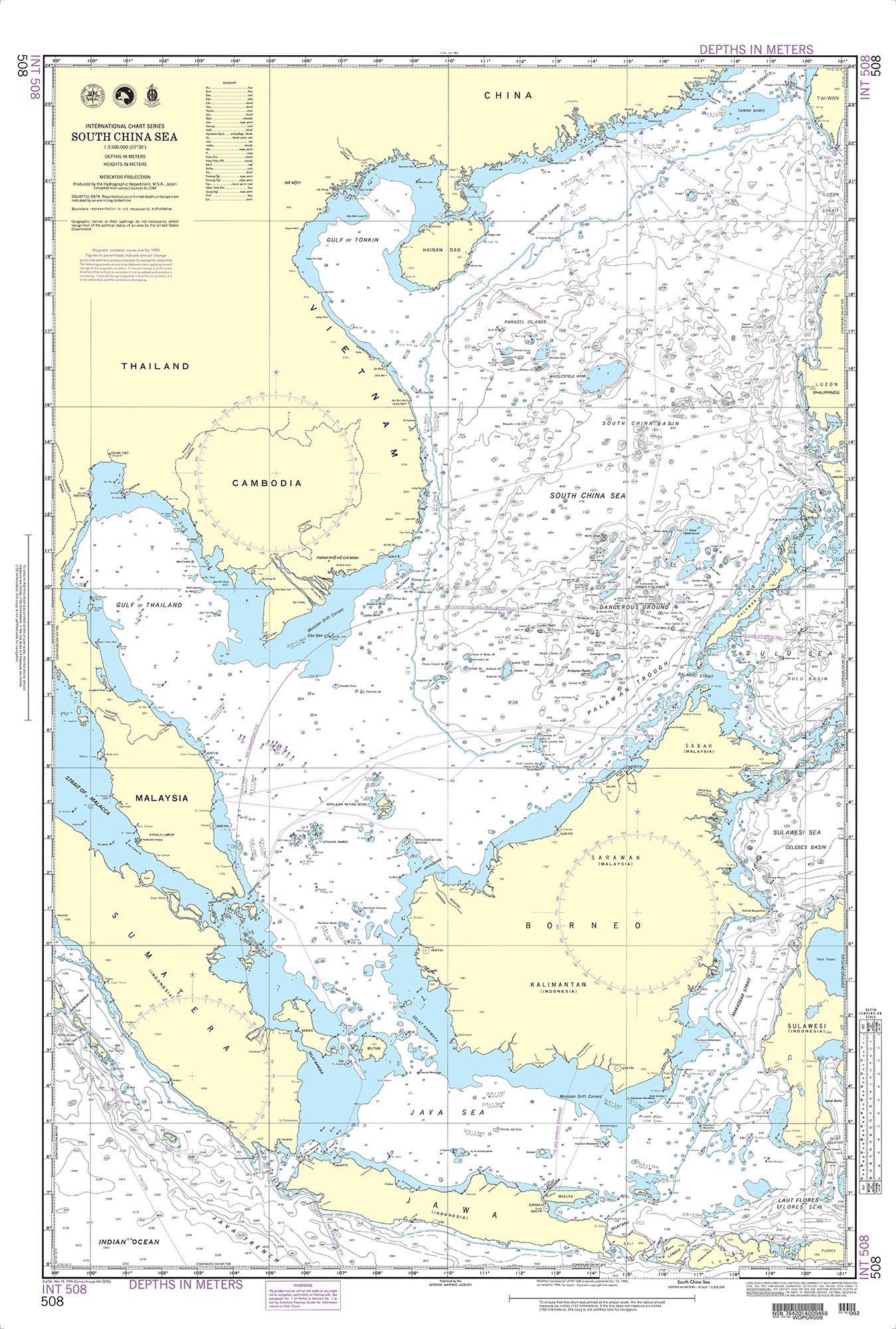
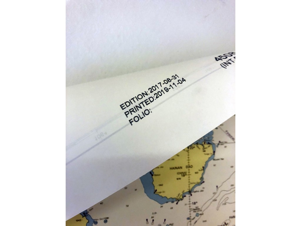
British Admiralty Nautical Chart 4508: Pacific Ocean, South China Sea.
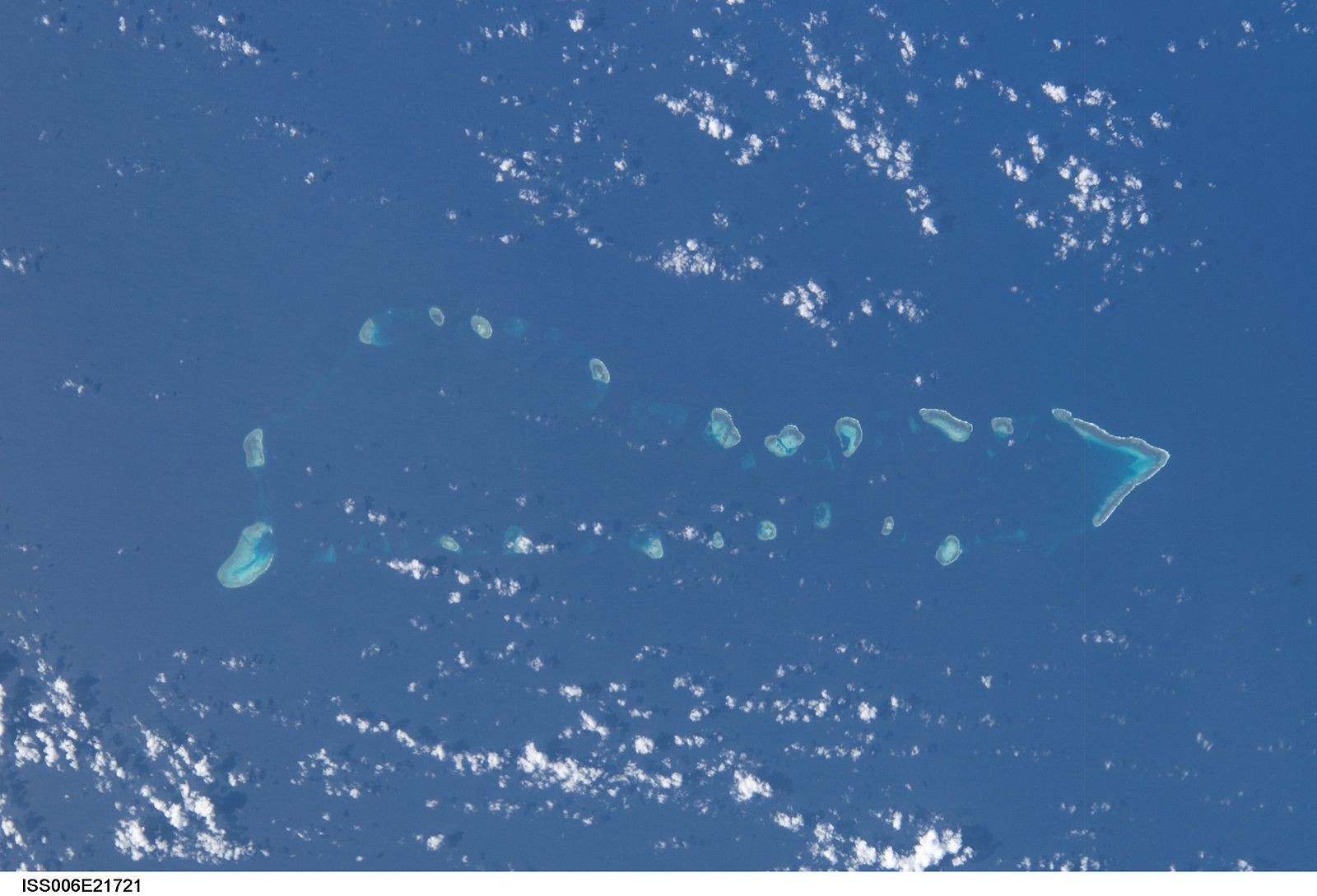
Photograph from the International Space Station of the South China Sea which includes Union Reefs, a part of Spratly Islands, 31 January 2003.
Image Science and Analysis Laboratory, NASA-Johnson Space Center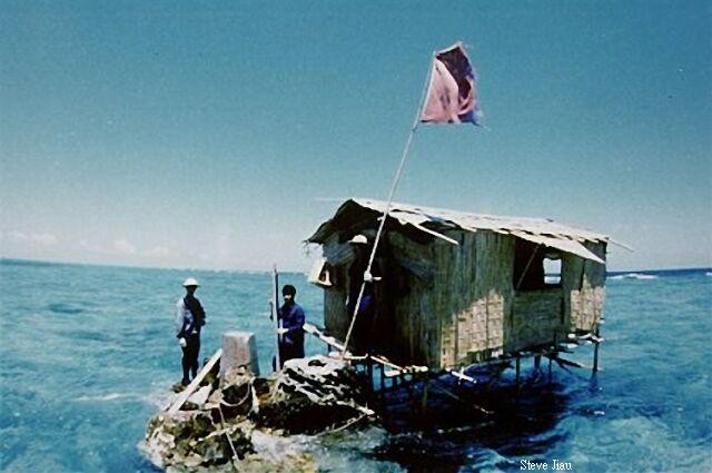
First settlement on Fiery Cross Reef, 1988.
Steve JiauOver the course of just one year this happened on Fiery Cross Reef. A new island was constructed with a harbor, sea walls, a hospital, military barracks, helipads, a multi-story tower, a running track, basketball and tennis courts, and an airstrip.

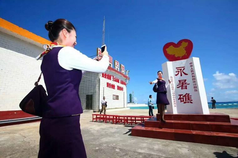
Chinese stewardesses pose on Fiery Cross Reef to celebrate the test flights carried out by two commercial airliners on January 6, 2016.
XinhuaThis land reclamation campaign extends to other islands in the area. The Asia Maritime Transparency Initiative run by the Center for Strategic and International Studies in Washington has an extensive database where all the changes are tracked.
This is Cuarterton Reef. It used to be a rock occupied and controlled by China but claimed by the Philippines and Taiwan.
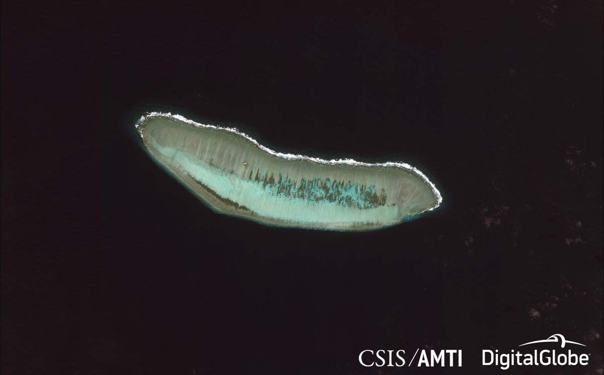
Cuarterton Reef in 2014.
AMTI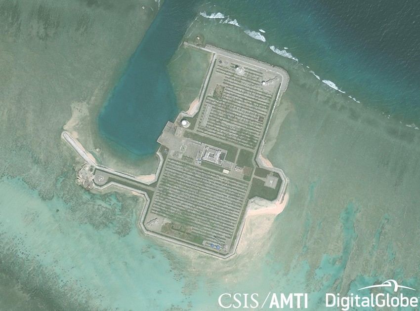
Cuarteron Reef in 2017.
AMTIThis is Mischief Reef in 2012. It is located in the so-called ‘Dangerous Ground’ of the South China Sea. An area which is very tricky to navigate through during low tide.
Mischief Reef in 2012.
AMTI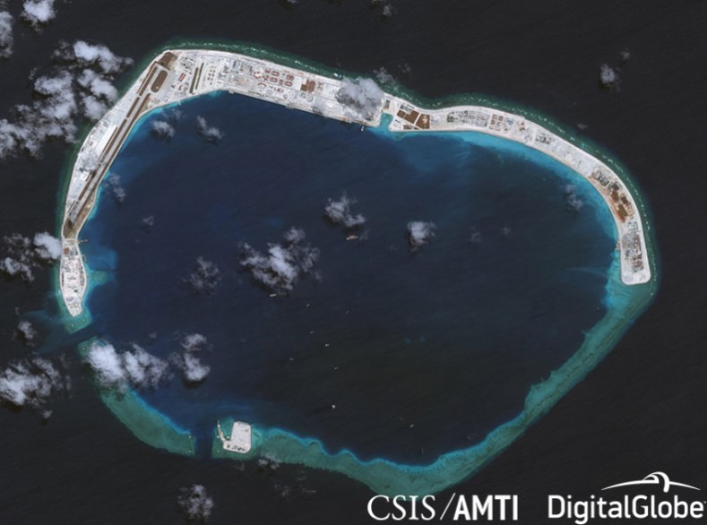
Mischief Reef in 2017.
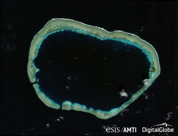
AMTIAnd this is what Subi Reef looked liked, also an atoll. At low tide land emerged. But most of the time it was underwater.
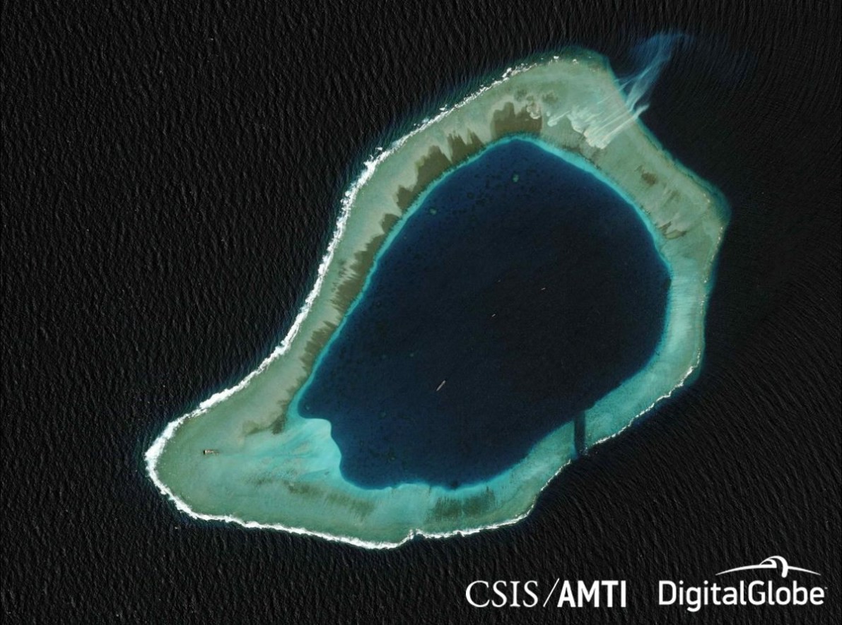
Subi Reef in 2012.
AMTI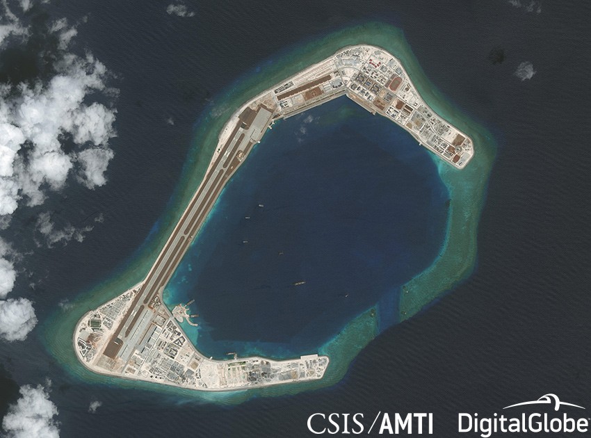
Subi Reef in 2017.
AMTI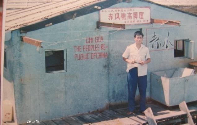
First settlement on Johnson Reef (Chi Gua), note the hyphen in THE PEOPLES RE-PUBLIC OF CHINA, 1988.
Steve Jiau

Overview of Johnson South Reef made by a Philippine newspaper in 2017.
Philippine Daily Inquirer
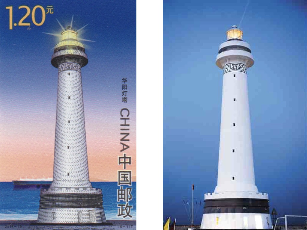
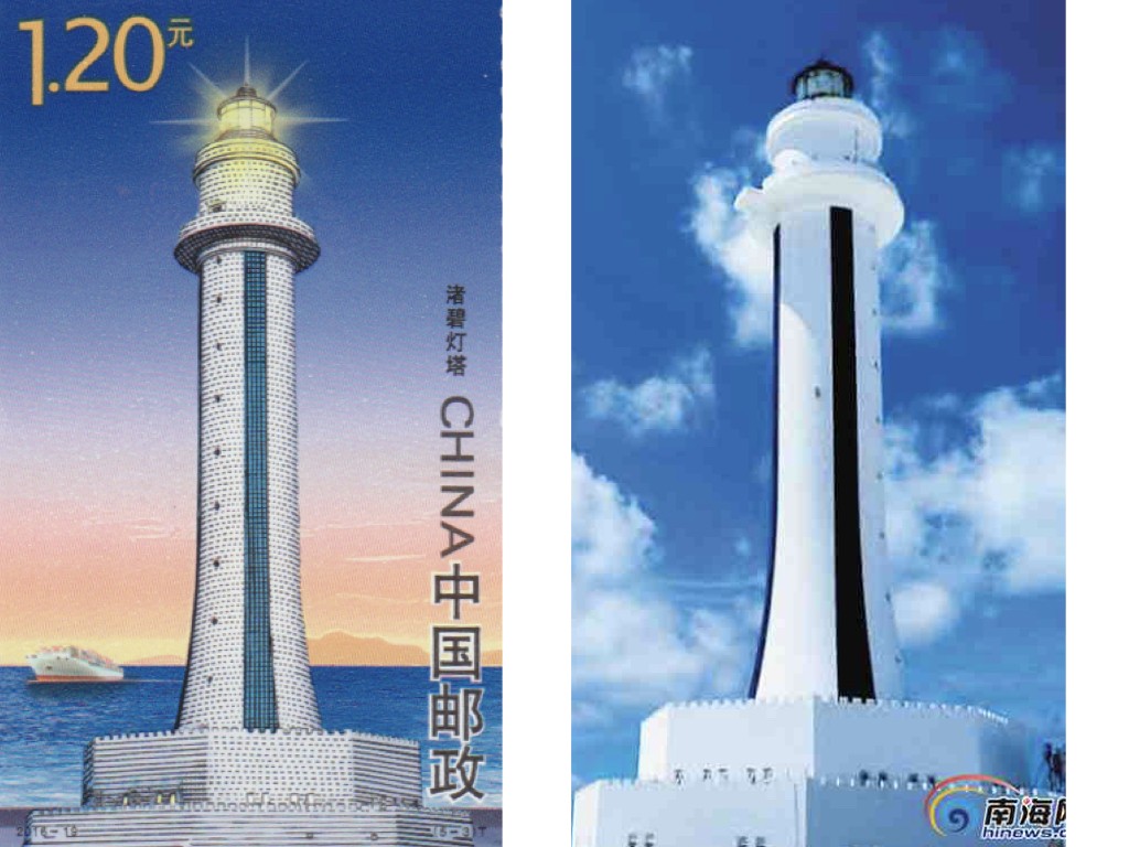
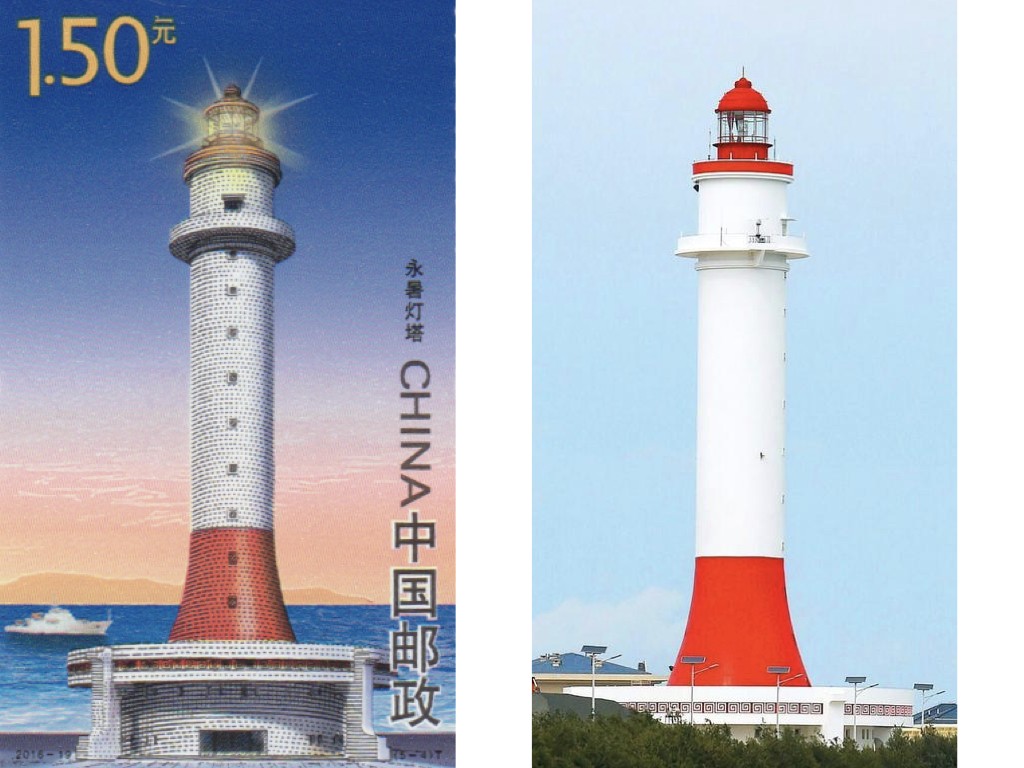
Lighthouses on the Spratly Islands, 1.20-1.5, People Republic of China, October 2016.
China PostSo this is the lighthouse of Cuarteron Reef. It has a reversed swastika sign which forms a geometric pattern. In the western iconography the swastika is strongly associated with the Nazi regime, but in the East it has different connotations. In Hindu religion the swastika is a symbol for day and the reversed sign symbolizes the night – which would make sense for a lighthouse.
This is the stamp of Subi Reef, an elegant black and white design. The black and white stripes also mark out the tower from the horizon and make it easier to spot the lighthouse. On the stamp we can see other land in the background and a tourist boat is approaching.
This is the lighthouse of Mischief Reef. It looks like a Chinese casino, or a ‘pagoda’, as it stands. This reef is very close to the Philippines and they also protested when China started to reclaim land here. And when this lighthouse was erected.

Here is the lighthouse on Johnson Reef, this has a variation of what we know as the meander border. But in China it is known as two represent clouds and thunder patterns. Thus bringing life because of rain.

Lighthouse on Johnson Reef.
This is how things started. A small settlement on a rock with tanks for freshwater.
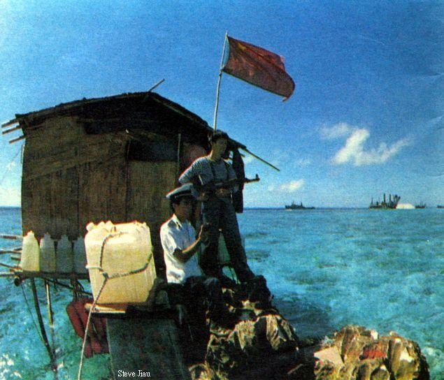
First settlement on Fiery Cross Reef, 1988.
Steve Jiau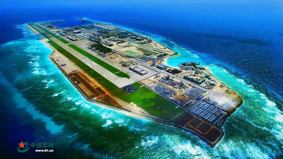
Overview of Fiery Cross Reef.
People’s Daily